


Lightweight handheld spatial scanning for engineering, Scan-to-BIM, surveying, digital twins, 3D Gaussian Splatting and reality capture.
REQUEST A QUOTE VIEW SPECIFICATIONS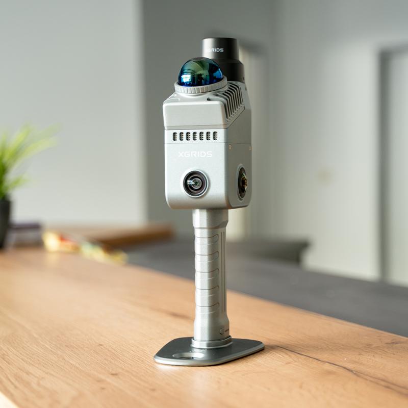
The XGRIDS Lixel K2 is a compact handheld LiDAR scanner designed to make professional reality capture fast and easy.
Simply walk through the environment while the K2 captures LiDAR and camera data in real time, producing a live true-color point cloud that lets you verify coverage while you scan.
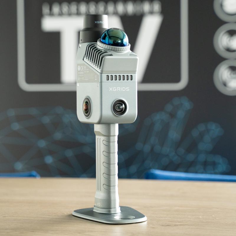
At approximately 1.2 kg, the K2 combines a 360° LiDAR sensor, three-camera vision system, integrated RTK and onboard processing in a highly portable platform.
The K2 is designed for field operators who need fast capture without setting up traditional tripod-based scanners at dozens or hundreds of positions.
Centimeter-class relative accuracy for engineering documentation, BIM and spatial measurement workflows.
Rapid LiDAR acquisition captures dense spatial information as you move through the site.
Portable one-handed operation makes long capture sessions significantly easier.
RMSE specification.
LiDAR acquisition rate.
Maximum LiDAR cutoff range.
Built-in eMMC storage.
The Lixel K2 combines two fisheye cameras with a dedicated forward-facing camera.
The front camera is a major improvement for color quality, helping generate more natural point clouds and higher-quality 3D Gaussian Splatting models.

The mobile LiDAR system continuously measures the environment as the operator walks through the site.
Traditional terrestrial laser scanning often requires repeated setup and repositioning.
The K2 uses mobile SLAM so the operator can continuously move through rooms, corridors, stairs and complex environments.
This can dramatically reduce field-capture time for suitable projects.
The RTK module is integrated directly into the Lixel K2 rather than requiring an external receiver attached to the scanner.
Georeference suitable outdoor projects without attaching a separate RTK module to the scanner.
K2 data can be transformed into engineering point clouds, mesh models and photorealistic 3D Gaussian Splatting scenes.
Create measurement-ready point clouds for surveying, engineering and Scan-to-BIM applications.
Convert spatial data into polygonal mesh geometry for visualization and downstream workflows.
Generate highly photorealistic navigable spatial models using Lixel CyberColor.
Colorized spatial data can be viewed during the capture process through the LixelGO mobile application.
This allows operators to identify missed areas before leaving the site, reducing the chance of costly return visits.
Connect to the scanner, control acquisition and monitor the point cloud in real time.
Process captured data for surveying, mapping, measurements, mesh and engineering workflows.
Transform K2 captures into highly photorealistic 3D Gaussian Splatting environments.
Capture existing conditions quickly and transform them into spatial data for downstream CAD and BIM workflows.
The K2 is particularly well suited to small and medium-sized building capture where fast field collection is critical.
Protection against harmful dust accumulation and splashing water.
Approximately 1.5 hours of operation per removable battery.
Designed for a wide range of field temperatures.
Capture existing buildings for BIM modeling and renovation.
Document progress, verify existing conditions and support project management.
Capture floor plans, spaces and buildings for renovation and documentation.
Digitally archive historical buildings, interiors and cultural environments.
Capture stockpiles for volume calculations and inventory measurement.
Create spatial datasets for visualization, VR/AR and digital twin applications.
Lightweight handheld architecture for mobile reality capture.
LiDAR and camera fusion for true-color spatial data.
GNSS RTK is built directly into the K2 hardware.
Approximately 1.2 kg with battery and base.
| LiDAR | |
|---|---|
| Scanner Type | Handheld Mobile LiDAR / SLAM Scanner |
| Laser Class | Class 1 / 905 nm |
| Point Rate | 200,000 Points/Second |
| Scan Range | ≥40 m at 10% Reflectivity |
| Maximum Range | 100 m |
| LiDAR Field of View | 360° × -7° to +52° |
| Accuracy | |
| Relative Accuracy | 1 cm RMSE |
| Absolute Horizontal Accuracy | 3 cm RMSE under suitable RTK conditions |
| Absolute Elevation Accuracy | 3 cm RMSE under suitable RTK conditions |
| Repeatability | 2 cm |
| Post-Processed Point Cloud Thickness | ≤1 cm |
| Vision System | |
| Camera Count | 3 Cameras |
| Camera Configuration | 2 Fisheye + 1 Forward-Facing Camera |
| Camera Resolution | 4000 × 3000 |
| Panoramic Camera FOV | 200° × 200° |
| Forward Camera FOV | 100° × 85° |
| CMOS Sensor | 1/2" |
| GNSS / RTK | |
| RTK Module | Built-In |
| Positioning Workflows | RTK / PPK |
| Coordinate Systems | WGS84 / CGCS2000 |
| GNSS Support | GPS, BDS, GLONASS, Galileo, QZSS and SBAS |
| Hardware | |
| Weight | Approximately 1.2 kg Including Battery & Base |
| Housing | Aviation-Grade Aluminum |
| Internal Storage | 512 GB eMMC |
| Data Interface | USB 3.1 Gen 2 |
| Wi-Fi | 2.4 GHz / 5 GHz |
| Bluetooth | Supported |
| Power Consumption | <20 W |
| Battery & Environment | |
| Battery Type | Removable / Clip-On |
| Battery Capacity | 1,900 mAh |
| Operating Time | Approximately 1.5 Hours |
| Operating Temperature | -20°C to +50°C |
| Protection Rating | IP54 |
| Data & Software | |
| Real-Time Output | Colorized Point Cloud |
| Post-Processed Outputs | Point Cloud, Mesh and 3D Gaussian Splatting |
| Point Cloud Format | LAS and Supported Downstream Formats |
| Mobile Software | LixelGO |
| Point Cloud Software | LixelStudio |
| 3DGS Software | Lixel CyberColor / LCC Studio |
Rapid Scan 3D can help you evaluate the Lixel K2 for reality capture, Scan-to-BIM, construction documentation, digital twins and 3D visualization workflows.
Determine whether the K2 provides the right accuracy, range and workflow for your projects.
Understand how LixelGO, LixelStudio and Lixel CyberColor fit into your workflow.
Work with Rapid Scan 3D to integrate mobile LiDAR and reality capture into your organization.
Contact Rapid Scan 3D for XGRIDS Lixel K2 pricing, demonstrations, application assistance and purchasing information.
REQUEST A QUOTE

