


Capture complex environments with a high-accuracy handheld LiDAR scanner designed for surveying, Scan-to-BIM, digital twins, industrial documentation and immersive 3D content.
One capture can support a true-color point cloud, textured mesh and 3D Gaussian Splatting workflow.
REQUEST A QUOTE VIEW SPECIFICATIONS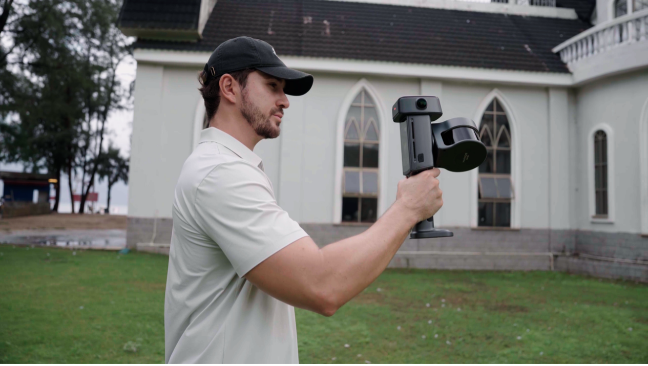
The XGRIDS Lixel L3 combines high-performance LiDAR, true-color imaging, built-in multi-GNSS RTK, an IMU and onboard display into one portable scanning platform.
Designed for professionals who need fast field capture without sacrificing accuracy, the L3 supports high-density point clouds, georeferenced workflows and photorealistic reconstruction.
One field session can produce engineering, visualization and immersive digital-twin deliverables.
High-density measurable data for CAD, BIM, GIS, inspection and existing-condition documentation.
Formats: LAS, E57, RCP, PLY, iLASCreate detailed surface models for engineering, visualization, heritage capture and digital twins.
Formats: OBJ, OSGBTransform the capture into photorealistic 3DGS environments using XGRIDS Lixel CyberColor.
Formats: LCC, LCC2, PLYThe built-in display allows the operator to monitor the capture while scanning, reducing dependence on a separate phone or tablet.
High-brightness field display for operating the scanner.
Monitor scanner movement and capture progress in real time.
Confirm important areas have been captured before leaving.
Review captured spatial data directly in the field.
The Lixel L3 combines LiDAR geometry with high-resolution color imagery, providing richer context for point clouds, meshes and photorealistic digital twins.
High-resolution image output.
Improved detail across highlights and shadows.
Forward-facing camera plus dual panoramic cameras.
Built-in multi-frequency GNSS and RTK capabilities simplify professional outdoor mapping and georeferenced point-cloud workflows.
Global positioning support.
Additional satellite positioning coverage.
European GNSS constellation support.
Additional GNSS positioning capability.
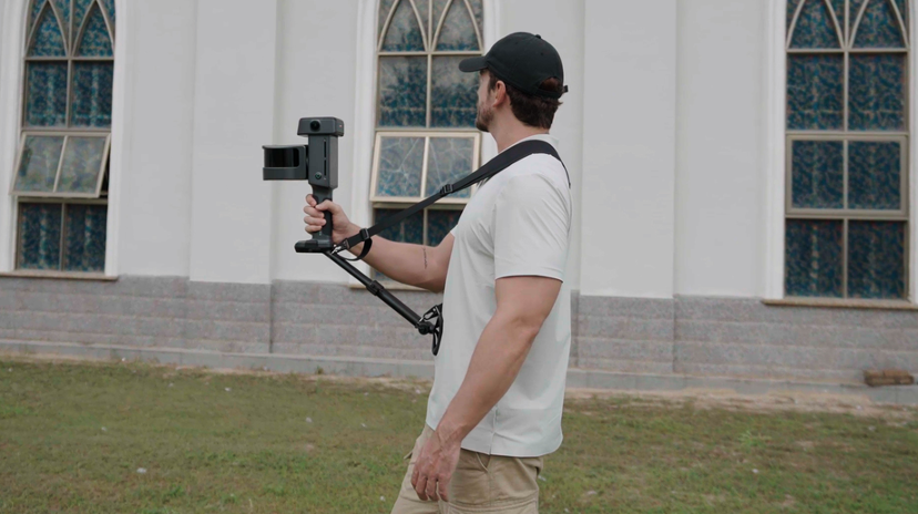
Move naturally through the environment while the L3 continuously captures geometry, color, positioning and motion data.
Topographic mapping, control and existing-condition documentation.
Capture buildings and MEP systems for BIM and CAD workflows.
Progress documentation, as-built capture and site verification.
Combine measurable geometry with photorealistic visual context.
Factories, warehouses, plants and mechanical environments.
Roads, bridges, tunnels and transportation assets.
Document historical architecture and cultural environments.
Virtual production, location capture and immersive environments.
| LiDAR | |
| Configurations | 16-channel / 32-channel |
| Working Range | 0.7-120 m |
| Point Rate | Up to 640,000 points per second |
| Field of View | 360 degrees x 270 degrees |
| Laser | 905 nm Class 1 |
| Accuracy | |
| Post-Processed Relative Accuracy | 5 mm typical* |
| Post-Processed Absolute Accuracy | Approx. 2 cm RMSE* |
| Real-Time Relative Accuracy | Approx. 1 cm* |
| Real-Time Absolute Accuracy | Approx. 2.5 cm RMSE* |
| Imaging | |
| Sensor | 1/1.3-inch CMOS |
| Resolution | 4096 x 3072 |
| HDR | DCG 4K HDR |
| Positioning & Field Use | |
| RTK | Built-in multi-frequency GNSS / RTK |
| GNSS | GPS / GLONASS / Galileo / BeiDou |
| Display | 4.3-inch high-brightness display |
| Storage | 1 TB |
| Weight | Approx. 2.5 kg including battery |
| Operating Time | Approx. 100 minutes |
| Protection | IP54 |
| Output | |
| Point Cloud | LAS, RCP, E57, PLY, iLAS |
| Mesh | OSGB, OBJ |
| 3DGS | LCC, LCC2, PLY |
*Manufacturer performance figures are based on documented XGRIDS test conditions. Actual results vary depending on environment, scan path, GNSS conditions, scene geometry, processing settings and operator technique.
Collect LiDAR, color, RTK and motion data while moving naturally through the site.
Process, optimize, measure, colorize and export professional point-cloud and mesh deliverables.
Generate photorealistic Gaussian Splatting environments for immersive visualization and digital twins.
Rapid Scan 3D helps evaluate accuracy requirements, site conditions, software workflows and deliverables to configure the right XGRIDS solution.
Determine whether the Lixel L3 is the right system for your project and accuracy requirements.
See the scanner capture real environments and review actual point-cloud and visualization results.
Get help integrating XGRIDS into CAD, BIM, surveying, engineering and digital-twin workflows.
Contact Rapid Scan 3D for pricing, availability, demonstrations and application assistance.
REQUEST A QUOTE EMAIL RAPID SCAN 3DRapid Scan 3D | 562-912-3544 | info@rapidscan3d.com


