


GPS-Denied Mapping
SLAM-based positioning allows accurate mapping in tunnels, mines, indoor facilities, and other locations where GPS is unavailable.



Artec Jet is a high-speed SLAM LiDAR mapping system built for rapid capture of sites, facilities, tunnels, industrial plants, roads, bridges, mines, and infrastructure — including GPS-denied environments. Deploy it by hand or integrate it with backpacks, vehicles, robots, or drones for flexible mobile mapping and autonomous data capture.

Artec Jet combines mobile LiDAR, SLAM positioning, autonomous deployment, and rapid point-cloud capture to digitize complex environments faster than traditional static scanning workflows.
SLAM-based positioning allows accurate mapping in tunnels, mines, indoor facilities, and other locations where GPS is unavailable.
Capture large sites, roads, structures, industrial assets, and outdoor terrain from substantial working distances.
Triple-return acquisition rapidly collects dense point clouds for large-scale mapping and documentation.
Use Jet handheld or integrate it with backpacks, vehicles, robots, and drones to match the requirements of each project.
AI-powered autonomy can support waypoint-based drone capture in hard-to-reach and GPS-denied environments.
IP65 protection and operation from -10°C to 45°C support demanding industrial and outdoor environments.
Explore mobile LiDAR applications across underground mapping, urban environments, infrastructure, and industrial facilities.
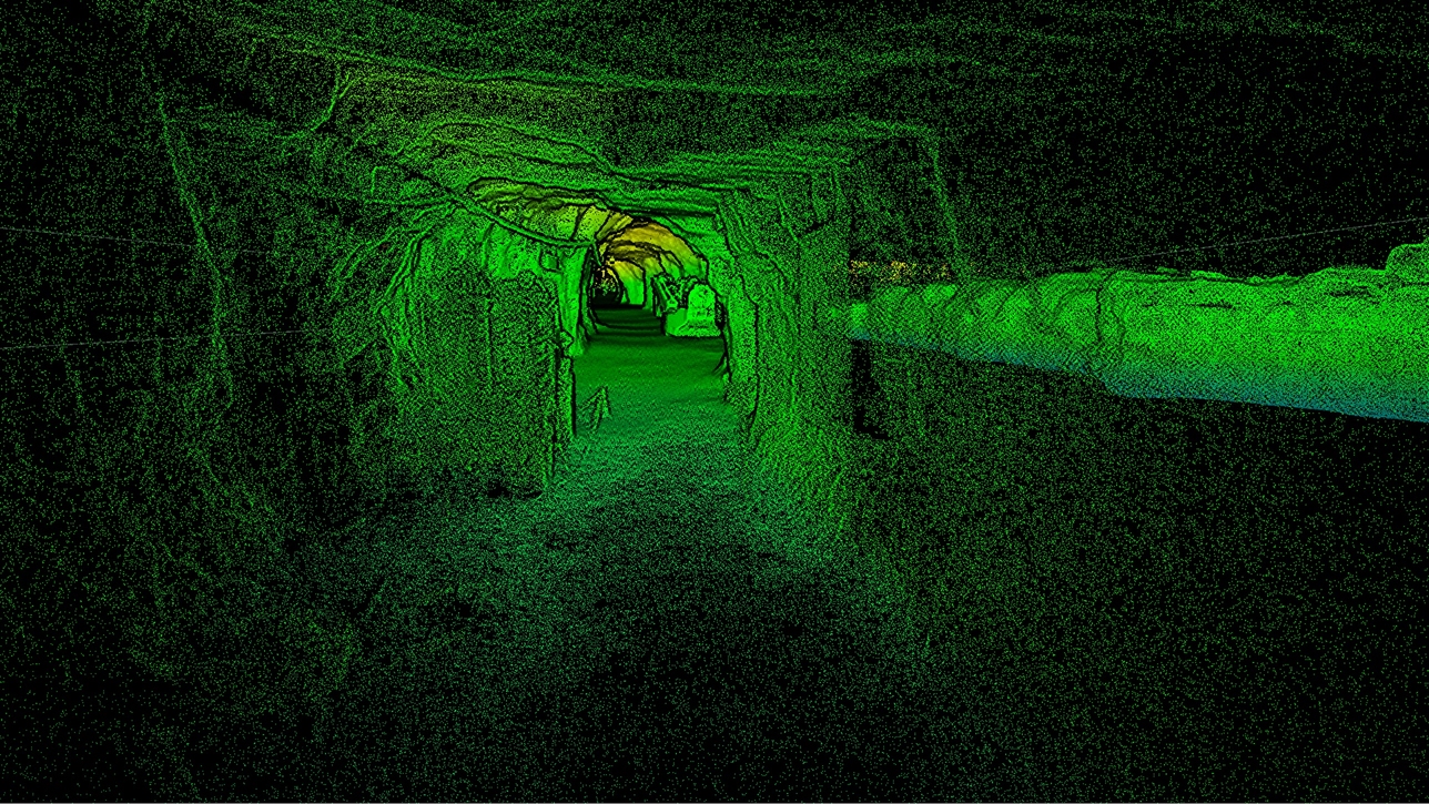
Capture tunnels, shafts, headings, and confined spaces without relying on GPS.
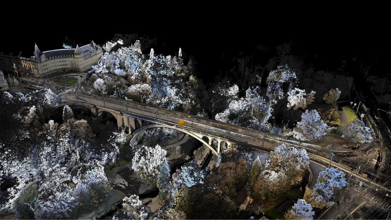
Digitize bridges, roads, rail corridors, terrain, and large outdoor environments.
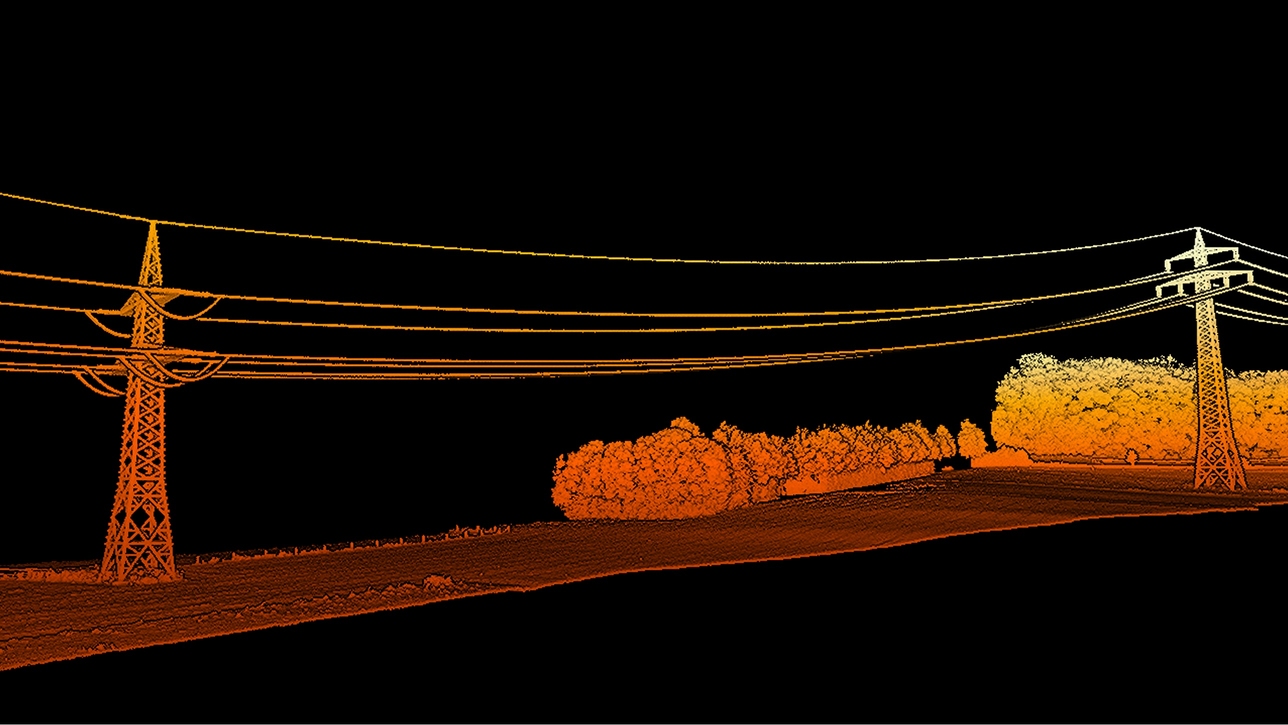
Capture utilities, power infrastructure, civil assets, and surrounding terrain.
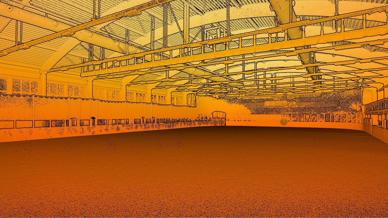
Document factories, plants, warehouses, refineries, and processing environments.
Product and application imagery courtesy of Artec 3D and Rapid Scan 3D.
1. Choose deployment: Handheld, backpack, vehicle, robot, or drone.
2. Capture: Move through the environment while SLAM continuously estimates scanner position.
3. Georeference: Use RTK/GNSS where available for larger outdoor and linear projects.
4. Process: Generate registered point clouds for digital twins, BIM, inspection, measurement, or planning.
Key specifications for the Artec Jet high-precision mobile SLAM LiDAR scanner.
| Mapping method | SLAM-based LiDAR mapping |
|---|---|
| SLAM drift | Approximately ±0.03% |
| LiDAR range | 0.5 to 300 m |
| LiDAR accuracy | ±10 mm |
| General mapping accuracy | Up to approximately ±15 mm |
| Indoor / underground accuracy | Up to approximately ±10 mm |
| Change detection | Up to approximately ±5 mm |
| Field of view | 360° × 290° |
| Single-return acquisition | Up to 640,000 points/second |
| Triple-return acquisition | Up to 1,920,000 points/second |
| Maximum vehicle speed | 60 km/h / 37.3 mph |
| Maximum above-ground flight speed | 5 m/s / 16.4 ft/s |
| Laser class | Class 1, eye-safe |
| Environmental protection | IP65 |
| Operating temperature | -10°C to 45°C / 14°F to 113°F |
| Scanner weight | Approximately 1.57 kg / 3.46 lb |
| Internal storage | 512 GB, approximately 16 hours of sensor data |
| Positioning | GPS-free SLAM with optional georeferencing workflows |
| Low-light capability | LiDAR operation does not require ambient light |
Artec Jet is designed for teams that need mobile, flexible, repeatable site capture across both indoor and outdoor environments.
Map underground workings, stopes, shafts, headings, stockpiles, and hazardous areas with fewer personnel exposed to risk.
Capture as-built conditions, bridges, roads, tunnels, buildings, and construction progress for design and BIM workflows.
Digitize plants, refineries, offshore structures, pipelines, and equipment for inspection, maintenance, and planning.
Rapid Scan 3D is an authorized Artec 3D reseller, Gold Certified Partner, and Artec Ambassador with more than 15 years of professional 3D scanning experience.
We help evaluate range, accuracy, site conditions, deployment mode, software, deliverables, and project workflow.
Evaluate Jet for mining, AEC, industrial facilities, infrastructure, public safety, or digital-twin applications.
Get help with mobile mapping, SLAM capture, deployment planning, processing, measurement, and implementation.
Common questions about Artec Jet range, accuracy, SLAM, GPS-denied mapping, applications, deployment, and pricing.
Tell Rapid Scan 3D about your site size, operating environment, required accuracy, deployment method, GPS availability, final deliverables, and whether you need digital twins, BIM, inspection, or volumetric measurement.
| Specification | |
|---|---|
| Mapping | |
| Mapping method | SLAM-based LiDAR mapping, ±0.03% drift |
| LiDAR sensing range | 0.5–300 m (1.6–984 ft) |
| LiDAR accuracy | ±10 mm (3/8 in) |
| Mapping accuracy (general) | |
| Mapping accuracy (indoor/underground) | ±10 mm (3/8 in) |
| Change detection capability | ±5 mm (7/32 in) |
| Field of view | 360° × 290° |
| Acquisition (single return) | Up to 640,000 points/second |
| Acquisition (triple return) | |
| Max travel speed (vehicle) | 60 km/h (37.3 mph) |
| Max travel speed (flight, above ground) | 5 m/s (16.4 ft/s) |
| Max travel speed (flight, underground) | |
| Start/stop while walking or hovering | Yes |
| Laser class | Class 1 (eye safe) |
| Deep hole scanning | 1 single blue laser line |
| Hardware | |
| Scanner type | Handheld |
| Power source | AC/DC power adapter, 24V |
| Interface | USB 3.0 |
| 3D structured-light source | Class II blue laser (eye-safe) |
| Dimensions H×D×W | 203 × 80 × 44 mm |
| Weight | 0.57 kg/1.3 lbs |
| Warranty | 1 year |
| Certification | ISO 17025 accredited based on VDI/VDE 2634 & JJF 1951 |
| Dust protection | IP50 |
| Compatibility | |
| Supported OS | Windows 10, 11 |
| Recommended computer parameters | Intel processor with 8 cores, 16 threads, 2.6 GHz and above, 64+ GB RAM, GPU with 8 GB VRAM |
| Minimum computer requirements | Intel processor with 8 cores, 16 threads, 2.6 GHz and above, 32+ GB RAM, GPU with 4 GB VRAM |
| Output formats | |
| 3D mesh | OBJ, PLY, WRL, STL, AOP, ASC, PTX, E57, XYZRGB |
| CAD | STEP, IGES, X_T |
| Measurements | CSV, DXF, XML |