




Best In Class Warranty

Lixel L2 Pro

PROFESSIONAL MOBILE LIDAR • SLAM • RTK • TRUE COLOR

XGRIDS LIXEL L2 PRO

Professional high-density mobile LiDAR scanning for surveying, Scan-to-BIM, construction, infrastructure, digital twins and large-scale reality capture.

REQUEST A QUOTE VIEW SPECIFICATIONS
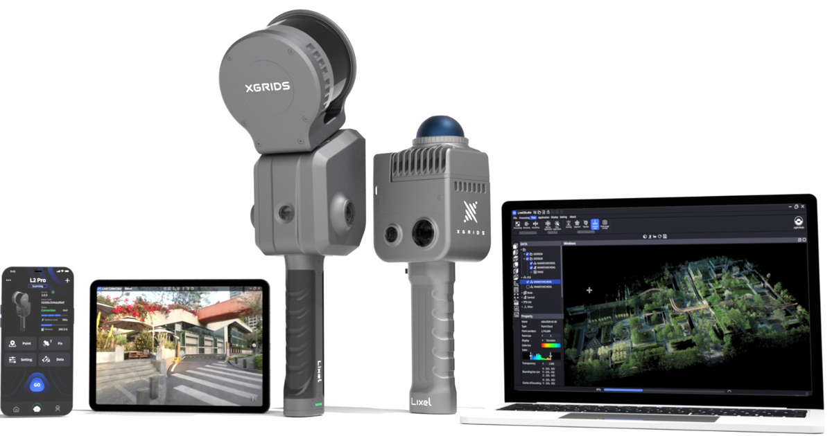
XGRIDS Lixel L2 Pro professional handheld LiDAR scanner

Precision Redefined

The XGRIDS Lixel L2 Pro combines LiDAR, panoramic vision, IMU, AI-enhanced SLAM and RTK positioning into a single professional mobile reality-capture platform.

The system delivers 3 cm real-time absolute accuracy and 1 cm processed relative accuracy while providing highly dense, true-color point clouds directly in the field.

With configurations reaching 300 meters and 640,000 points per second, the Lixel L2 Pro is designed for medium-to-large projects where speed, range and point density matter.

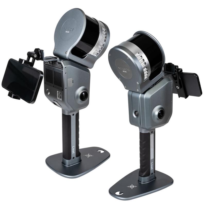
XGRIDS Lixel L2 Pro front and rear views

Integrated Professional Scanning Platform

The L2 Pro integrates the major components required for mobile spatial capture into a single handheld system.

  • Rotating LiDAR sensor
  • Dual panoramic cameras
  • High-precision IMU
  • AI-enhanced SLAM processing
  • Smartphone mount
  • Optional RTK positioning
  • Real-time color point clouds

Optional RTK Integration

The L2 Pro supports RTK workflows for projects that require point-cloud data positioned in absolute coordinates.

  • Real-time RTK fusion
  • Absolute-coordinate point clouds
  • Outdoor surveying
  • Infrastructure mapping
  • Control-point workflows
XGRIDS Lixel L2 Pro RTK configuration

Surveying Performance in a Handheld Platform

1 cm

Processed Relative Accuracy

High-quality spatial data for surveying, engineering and BIM.

3 cm

Absolute Accuracy

Centimeter-class positioning with suitable RTK workflows.

640K

Points Per Second

32-channel configurations capture up to 640,000 points/sec.

300 m

Maximum Range

Extended-range model.

640K

Points / Second

Maximum acquisition rate.

5 mm

Cloud Thickness

Processed planar thickness.

1 TB

Storage

Integrated SSD.

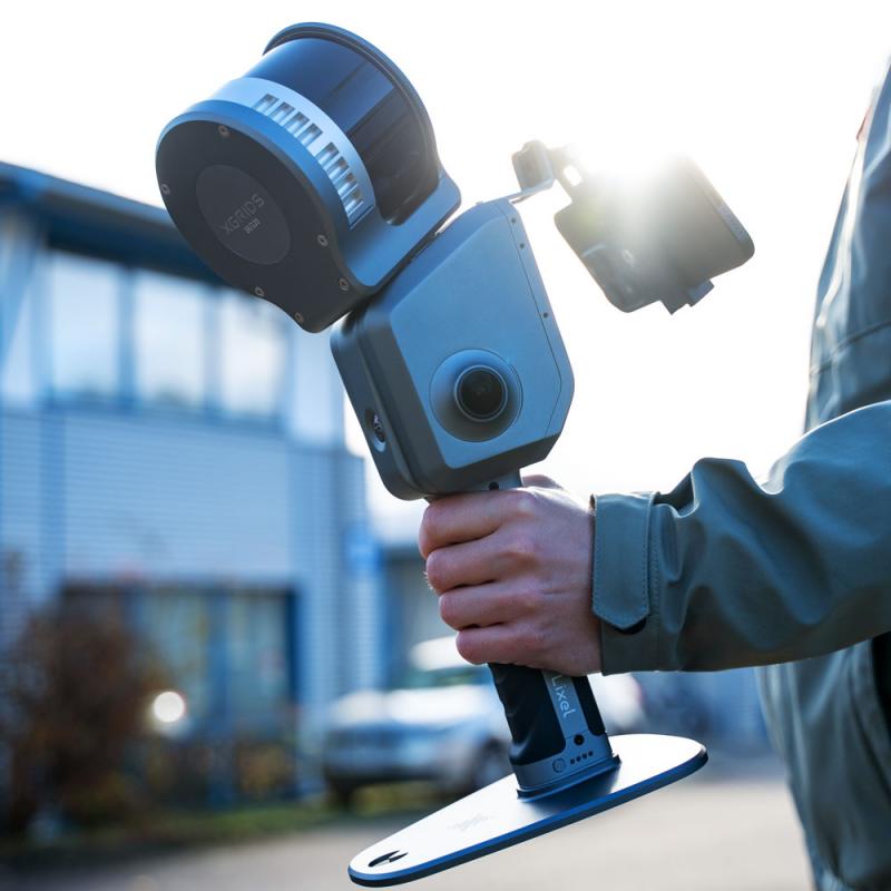
XGRIDS Lixel L2 Pro outdoor mobile scanning

Simply Walk and Capture

Lixel L2 Pro lets operators move continuously through a site while SLAM tracks scanner position and LixelGO provides real-time feedback.

  • Continuous walk-and-scan workflow
  • Real-time point-cloud visualization
  • Live true-color data
  • Coverage verification in the field
  • Reduced setup time

Choose the Right Lixel L2 Pro

Configuration Channels Range Point Rate
L2 Pro 16 / 120 16 0.5–120 m 320,000 pts/sec
L2 Pro 32 / 120 32 0.5–120 m 640,000 pts/sec
L2 Pro 32 / 300 32 0.5–300 m 640,000 pts/sec

Designed for Complex Environments

  • Factories
  • Warehouses
  • Tunnels
  • Mechanical rooms
  • Underground facilities
  • Multi-story buildings
  • Industrial plants
XGRIDS Lixel L2 Pro industrial scanning
1 mm

Ultra-Dense Point Cloud Output

LixelUpSample can enhance point-cloud density for detailed visualization and engineering deliverables.

  • Approximately 1 mm enhanced point spacing
  • Up to roughly 1 million points/m²
  • 5 mm processed point-cloud thickness
  • High-detail surface representation
LixelUpSample™
Point Cloud Enhancement

Increase point density beyond the raw LiDAR pattern for detailed downstream workflows.

2 × 48 MP
Panoramic Imaging

High-resolution cameras provide visual data for true-color spatial reconstruction.

Photorealistic Color Point Clouds

  • Two 48 MP panoramic cameras
  • Real-time RGB point clouds
  • High-resolution panoramic imagery
  • Colorized processed point clouds

Wide-Area LiDAR Coverage

  • 360° horizontal coverage
  • 270° vertical coverage
  • Class 1 eye-safe laser
  • 905 nm wavelength
  • 120 m and 300 m options
360° × 270°
LiDAR Field of View
300 m
Maximum Available Range
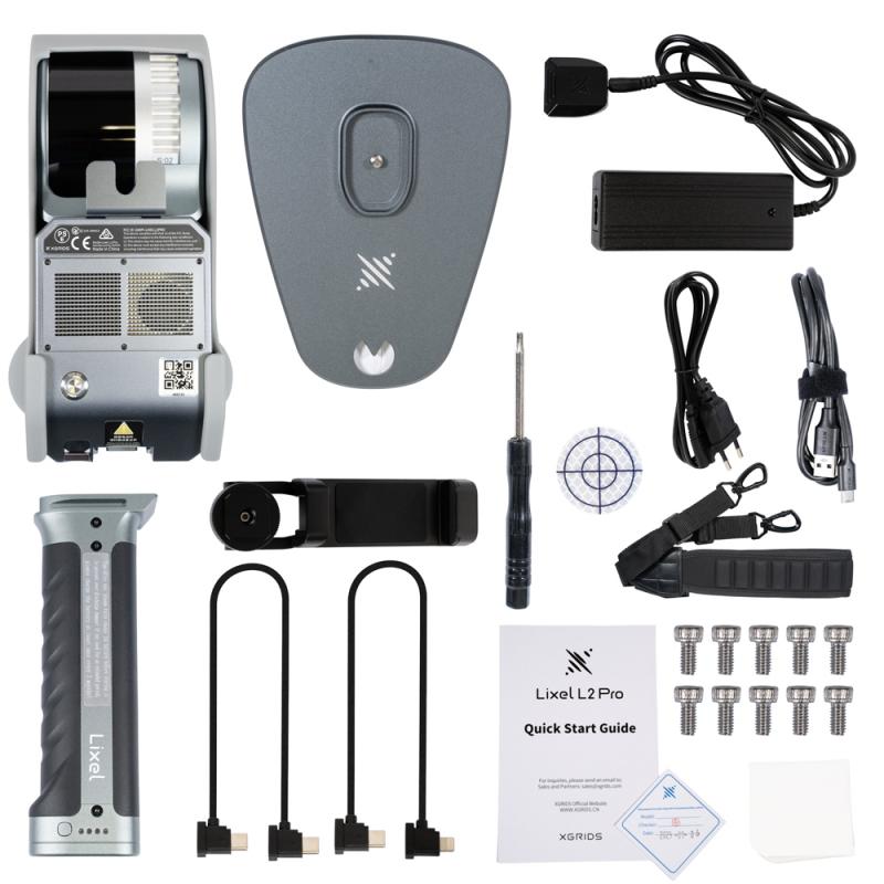
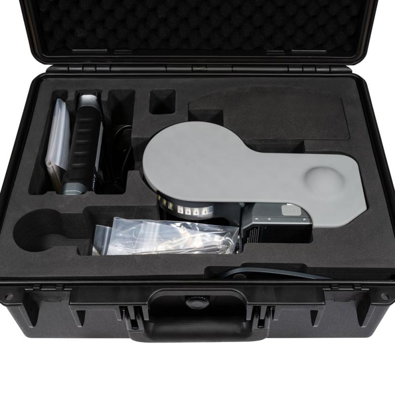
XGRIDS Lixel L2 Pro complete scanner kit

Professional Field Kit

  • Lixel L2 Pro scanner
  • Handle battery
  • Reference plate
  • Smartphone holder
  • Battery charger
  • USB data cables
  • Control points

Transport-Ready

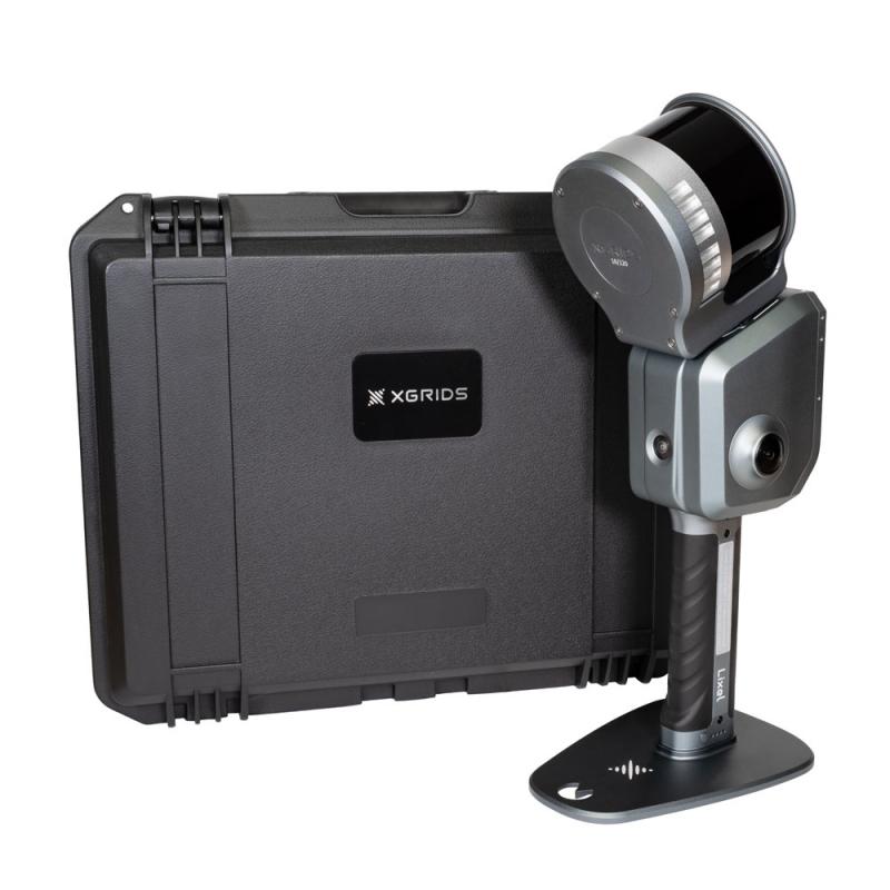
Built for professional field deployment with a protective transport case for construction, industrial and surveying projects.

XGRIDS Lixel L2 Pro transport case

Complete XGRIDS Software Workflow

LixelGO

Field Operation

Control scanning and visualize point clouds in real time.

LixelStudio

Point Cloud Processing

Process, enhance, measure and export survey data.

LCC

Lixel CyberColor

Create photorealistic 3D Gaussian Splatting environments.

BIM
Scan-to-BIM

Capture existing conditions quickly for downstream CAD and BIM workflows.

Built for AEC & Existing Conditions

  • As-built documentation
  • Existing-condition surveys
  • Reverse BIM modeling
  • Construction progress
  • MEP documentation
  • Renovation planning

One Scanner. Multiple Capture Platforms.

HANDHELD

Mobile SLAM

Walk through buildings, factories and outdoor sites continuously.

VEHICLE

Mobile Mapping

Optional vehicle mounting for roads, corridors and large sites.

DRONE

Airborne Capture

Compatible mounting solutions for enterprise UAV workflows.

Lixel L2 Pro Applications

Surveying & Topography

Terrain and mapping projects.

Scan-to-BIM

Building capture and renovation workflows.

Construction

Existing conditions and progress documentation.

Infrastructure

Roads, bridges, rail and tunnels.

Mining & Stockpiles

Volume calculations and site mapping.

Industrial Digital Twins

Factories and process environments.

Forestry

Terrain and vegetation capture.

Heritage

Historic structures and cultural sites.

Film & Visualization

Virtual production and 3DGS assets.

XGRIDS Lixel L2 Pro Gallery

XGRIDS Lixel L2 Pro Technical Specifications

Available Configurations
16-Channel / 120 m 320,000 Points per Second
32-Channel / 120 m 640,000 Points per Second
32-Channel / 300 m 640,000 Points per Second
Accuracy
Real-Time Absolute Accuracy Approx. 3 cm RMSE under suitable positioning conditions
Post-Processed Relative Accuracy 1 cm RMSE
Processed Point Cloud Thickness Approx. 5 mm
Enhanced Point Spacing Down to approx. 1 mm with LixelUpSample
LiDAR
Laser Class 1 / 905 nm
Scanning Range 0.5–120 m or 0.5–300 m
Scanning Rate 320,000 or 640,000 Points/sec
Field of View 360° × 270°
Camera & Imaging
Panoramic Cameras 2 × 48 MP
Real-Time Color Point Cloud Supported
Hardware
Scanner Weight Approx. 1.7 kg without battery
Dimensions Approx. 180 × 130 × 400 mm
Internal Storage 1 TB SSD
Data Interface USB 3.1 Gen 2
Protection Rating IP54
Battery & Environment
Battery Removable handle battery
Continuous Runtime Approx. 1.5 hours
Operating Temperature -20°C to +50°C
Positioning
SLAM Multi-Sensor / AI-Enhanced SLAM
IMU Integrated
RTK Optional Standard or Survey-Grade RTK
Software
Mobile Application LixelGO
Point Cloud Software LixelStudio
3DGS Software Lixel CyberColor / LCC Studio
Common Outputs LAS, E57, PLY, JPG and supported downstream formats

Purchase the XGRIDS Lixel L2 Pro from Rapid Scan 3D

Rapid Scan 3D can help determine the correct L2 Pro configuration, RTK setup and software workflow for your application.

Configuration Selection

Compare 16/120, 32/120 and 32/300 models.

Workflow Assistance

Evaluate RTK, control points, LixelStudio and LCC workflows.

3D Scanning Expertise

Integrate mobile LiDAR into engineering and production workflows.

Capture Large Environments Faster

Contact Rapid Scan 3D for XGRIDS Lixel L2 Pro pricing, demonstrations, RTK options, configuration recommendations and application assistance.

REQUEST A QUOTE
Lixel L2   Pro Specification
Weight 2.7kg
Size 180mm x 130mm x 400mm
Outer Casing Industrial-grade Aluminium
Power Consumption <30W
Interfaces USB 3.1 Gen2
Storage 1T SSD
Operating Temperature -20°C to +50°C / -4°F to +122°F
IP Rating IP54
Visual Positioning Supported
Real-time RGB Supported
Real-time RTK Fusion Supported
Point Cloud Formats .las
Image Formats .jpeg
Absolute Vertical Accuracy (RMSE) 3cm
Absolute Horizontal Accuracy (RMSE) 3cm
Relative Accuracy (RMSE) 2cm
Absolute Vertical Accuracy (RMSE) 2cm
Absolute Horizontal Accuracy (RMSE) 3cm
Relative Accuracy (RMSE) 1cm
Repeat Accuracy (RMSE) 2cm
Paint Cloud Thickness 0.5cm
Horizontality (with RTK) 0.015°
Verticality 0.03°
Operating Range 0.5m – 120m (0.5m – 300m)
Scanning Frequency 320,000 points/s (640,000 points/s)
LiDAR Sensor Class 1 / 905nm
Sensor FOV 360° × 270°
Resolution 2 × 45MP
Focal Length 2mm
Aperture F/2.0
Shutter Rolling Shutter
Panoramic Image Resolution Max 68MP
Resolution 1 × 1MP
FOV 109° × 119°
Shutter Global Shutter
Voltage 14.8V
Capacity 48.6Wh
Input 100V–240V 50–60Hz 1.5A 60W
Power Rating 74W
Output 16.8V 2.0A
Standard RTK Supported channels: GPS L1/L2/L5, GLONASS L1/L2, BDS B1/B2/B3, Galileo   E1/E5a/E5b/E6b. Accuracy: Horizontal: ±0.6cm + 1ppm, Vertical: ±1.5cm + 1ppm
Survey Grade RTK Supported channels: GPS L1/L2/L5, GLONASS L1/L2, BDS B1/B2/B3, Galileo   E1/E5a/E5b/E6b. Accuracy: Horizontal: ±0.6cm + 1ppm, Vertical: ±1.5cm + 1ppm
Backpack with Stabilizing Arm Dimensions: 50cm × 60cm × 15cm, Weight: 2.2kg
Shipping Case Dimensions: 42cm × 74cm × 38cm, Weight with System: 6.6kg
2m Extension Pole Supported
Mobile Phone Mount Supported
Control Point Plate Supported

Search