


Transform LiDAR, imagery and real-world capture into photorealistic, measurable and interactive 3D environments for digital twins, AEC, virtual production, real estate and spatial computing.
CONTACT RAPID SCAN 3D EXPLORE FEATURES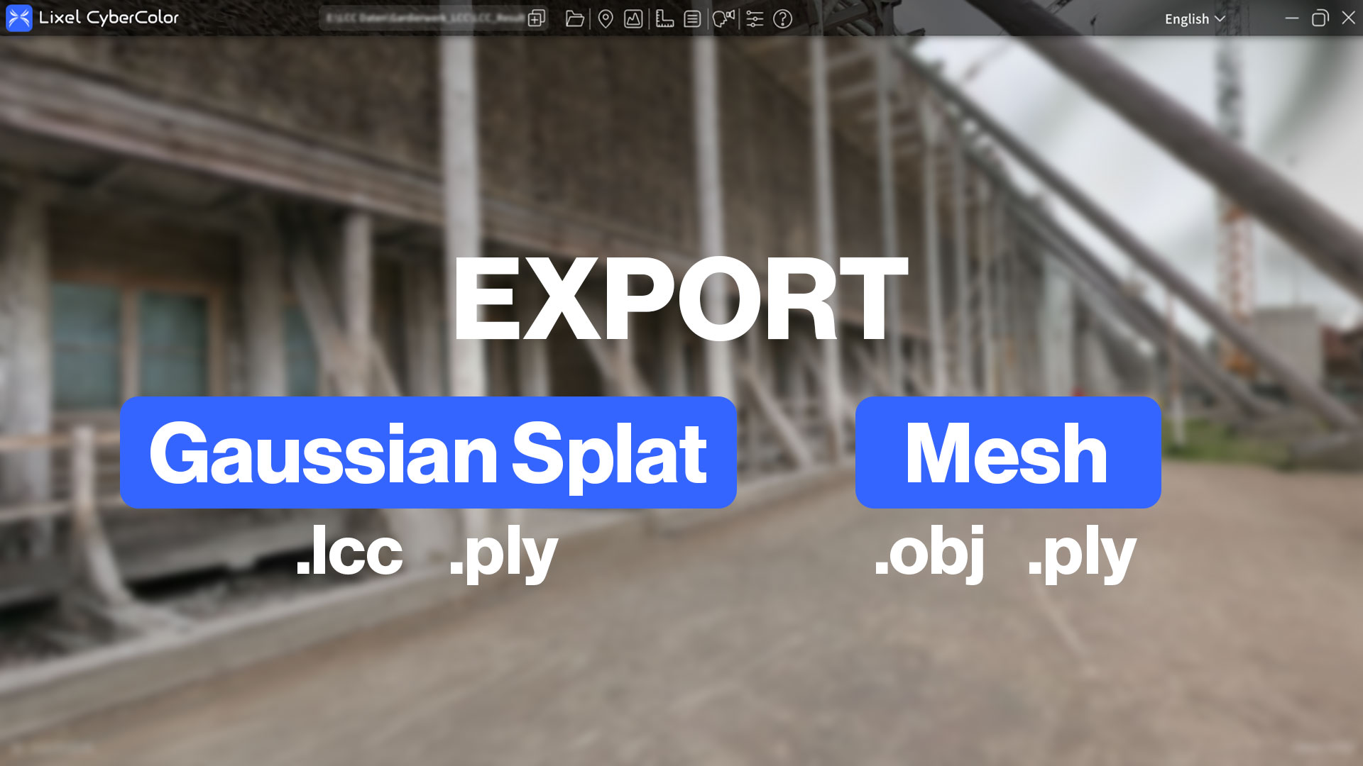
XGRIDS Lixel CyberColor, or LCC, is a spatial-content platform based on advanced 3D Gaussian Splatting technology.
It combines LiDAR geometry with visual data captured by compatible XGRIDS scanners to create highly realistic digital reproductions of real-world spaces.
Unlike a conventional textured mesh, LCC models preserve the visual appearance, lighting and spatial depth of a captured environment while remaining interactive and suitable for spatial computing.

LCC combines two important sources of spatial information: measured LiDAR geometry and high-resolution visual imagery.
The result is a model that looks significantly more realistic than a conventional point cloud while retaining useful spatial structure.
Generate immersive 3D Gaussian Splatting models with realistic lighting, texture and depth.
Use XGRIDS handheld scanners to capture entire spaces while walking naturally through them.
LiDAR information provides structural data that can support measurement and spatial overlays.
Gaussian Splatting reconstruction.
Can become a full interactive model.
XGRIDS states substantially smaller data than comparable workflows.
Share interactive scenes online.
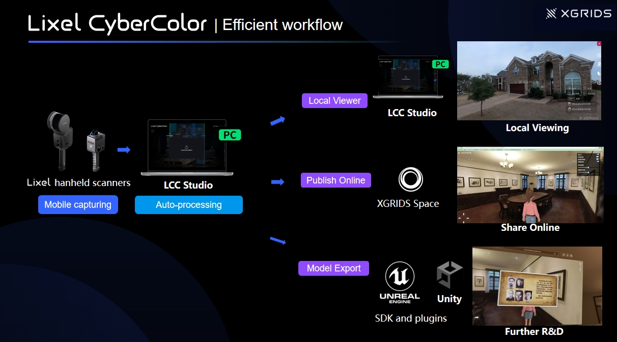
Record the environment with a compatible XGRIDS spatial scanner.
Import data into LCC Studio and automatically generate the Gaussian Splat model.
Clean, align, annotate, measure and enhance the scene.
Publish online or export into visualization, GIS and game-engine workflows.
LCC Studio is the primary reconstruction workstation for creating CyberColor models.
Import data captured by supported XGRIDS devices and automatically generate a high-quality 3DGS model.
Automatically transform real-world capture data into photorealistic spatial models.
LCC Studio can reconstruct compatible video footage into 3DGS environments.
Current LCC Studio versions support video reconstruction in addition to dedicated XGRIDS scanner data.
Large environments do not have to be captured in one continuous session.
LCC can combine multiple compatible capture segments to build larger continuous Gaussian Splat environments.
Build large digital spaces from multiple mobile reality-capture sessions.
LCC supports workflows where handheld scanner data and aerial imagery are combined into a single spatial model.
Record interiors, facades and accessible site geometry using XGRIDS handheld scanners.
Add drone imagery for roofs, terrain and inaccessible areas.
Combine datasets into one immersive spatial environment.
Transform reconstructed models into richer spatial experiences with navigation and information layers.
Scene Editor adds application-level tools on top of the reconstructed CyberColor model.
Model Editor provides tools for refining the underlying Gaussian model before delivery.
Remove unwanted content, align the scene and improve its visual presentation.
Real-world captures often include temporary people, vehicles and objects. LCC provides tools to help produce cleaner digital environments.
Reduce unwanted transient objects in captured scenes.
Remove unwanted Gaussian data and visual artifacts.
Align model geometry to a useful working coordinate system.
One of the important benefits of the XGRIDS workflow is the inclusion of LiDAR geometry.
This allows CyberColor models to support measurement and spatial-computing overlays rather than serving only as visual scenes.
Combine measurement-oriented spatial structure with photorealistic presentation.
LCC is designed to connect with other spatial-computing, visualization and GIS platforms.
Current LCC releases support multiple Gaussian Splatting, geospatial and traditional 3D formats.
LCC has expanded beyond pure visualization into geospatial spatial-computing workflows.
Connect photorealistic Gaussian models to broader geospatial ecosystems.
XGRIDS provides SDK and plugin workflows for integrating LCC scenes into interactive applications.
Use LCC data in advanced visualization, simulation, virtual production and XR.
Integrate spatial models into interactive applications and immersive experiences.
Build custom experiences and spatial applications around CyberColor data.
Publish supported scenes as online experiences for remote viewing.
LCC scenes can be published as interactive online experiences, allowing clients and collaborators to navigate a captured environment remotely.
Build visually realistic digital replicas of buildings, campuses and facilities.
Create highly immersive interactive property experiences.
Capture real locations for virtual sets, scouting and previsualization.
Combine measured geometry with intuitive visual documentation.
Preserve historical environments as immersive digital records.
Build navigable visual twins of factories and complex plants.
Use real captured environments in immersive spatial experiences.
Recreate real operational spaces for remote training and simulation.
Bring photorealistic spatial content into geospatial and smart-city platforms.
Generate photorealistic models from compatible K1 capture datasets.
Combine lightweight LiDAR scanning with CyberColor reconstruction.
Create large-scale CyberColor environments from professional LiDAR capture.
Purpose-built spatial camera optimized for high-quality 3DGS capture.
Current LCC Studio 2.4 expands the platform's connection to broader GIS and spatial ecosystems.
The two XGRIDS software platforms serve different primary workflows.
| Feature | Lixel CyberColor | LixelStudio |
|---|---|---|
| Primary Purpose | Photorealistic 3DGS spatial models | Engineering point-cloud processing |
| Visual Realism | Very High | Point-cloud focused |
| Gaussian Splatting | Core workflow | Not primary workflow |
| Measurements | Supported | Supported |
| Survey / BIM Point Clouds | Secondary | Primary |
| Unreal / Unity | Supported | Not primary workflow |
| Web Experiences | Supported | Not primary workflow |
| Best For | Digital twins, real estate, visualization, film, VR/AR | Surveying, CAD, BIM, measurements and engineering |
Rapid Scan 3D can help you design the right XGRIDS workflow from hardware capture through LCC reconstruction, editing, publishing and downstream integration.
Determine whether LCC, LixelStudio or a combination of both fits your application.
Match LCC with the appropriate K1, K2, L2 Pro or PortalCam.
Develop workflows for digital twins, real estate, film, BIM and spatial computing.
Contact Rapid Scan 3D to learn more about XGRIDS Lixel CyberColor, compatible scanners, software licensing, workflow requirements and 3D Gaussian Splatting applications.
CONTACT RAPID SCAN 3D

