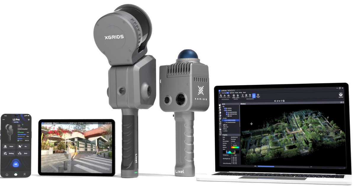


| Lixel L2 Pro | Specification |
|---|---|
| Weight | 2.7kg |
| Size | 180mm x 130mm x 400mm |
| Outer Casing | Industrial-grade Aluminium |
| Power Consumption | <30W |
| Interfaces | USB 3.1 Gen2 |
| Storage | 1T SSD |
| Operating Temperature | -20°C to +50°C / -4°F to +122°F |
| IP Rating | IP54 |
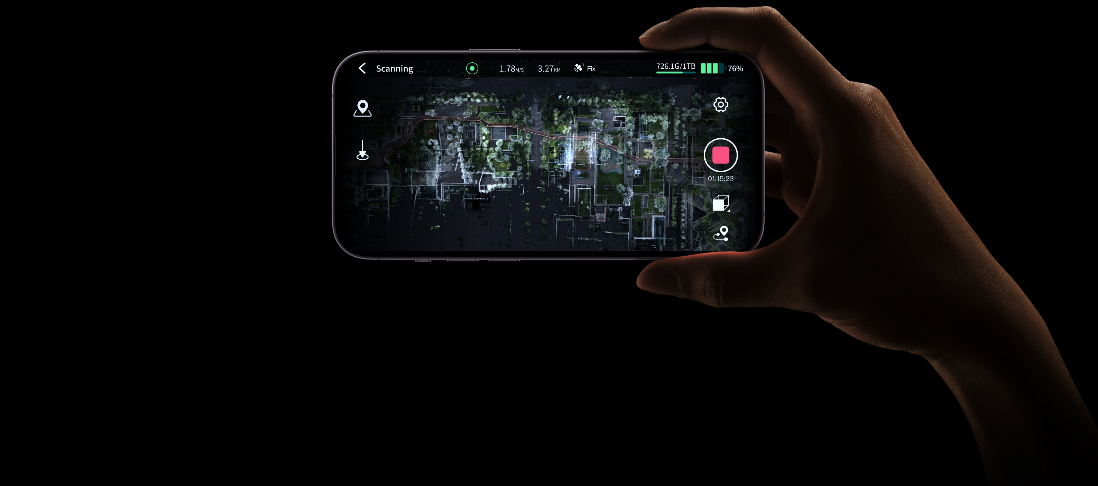
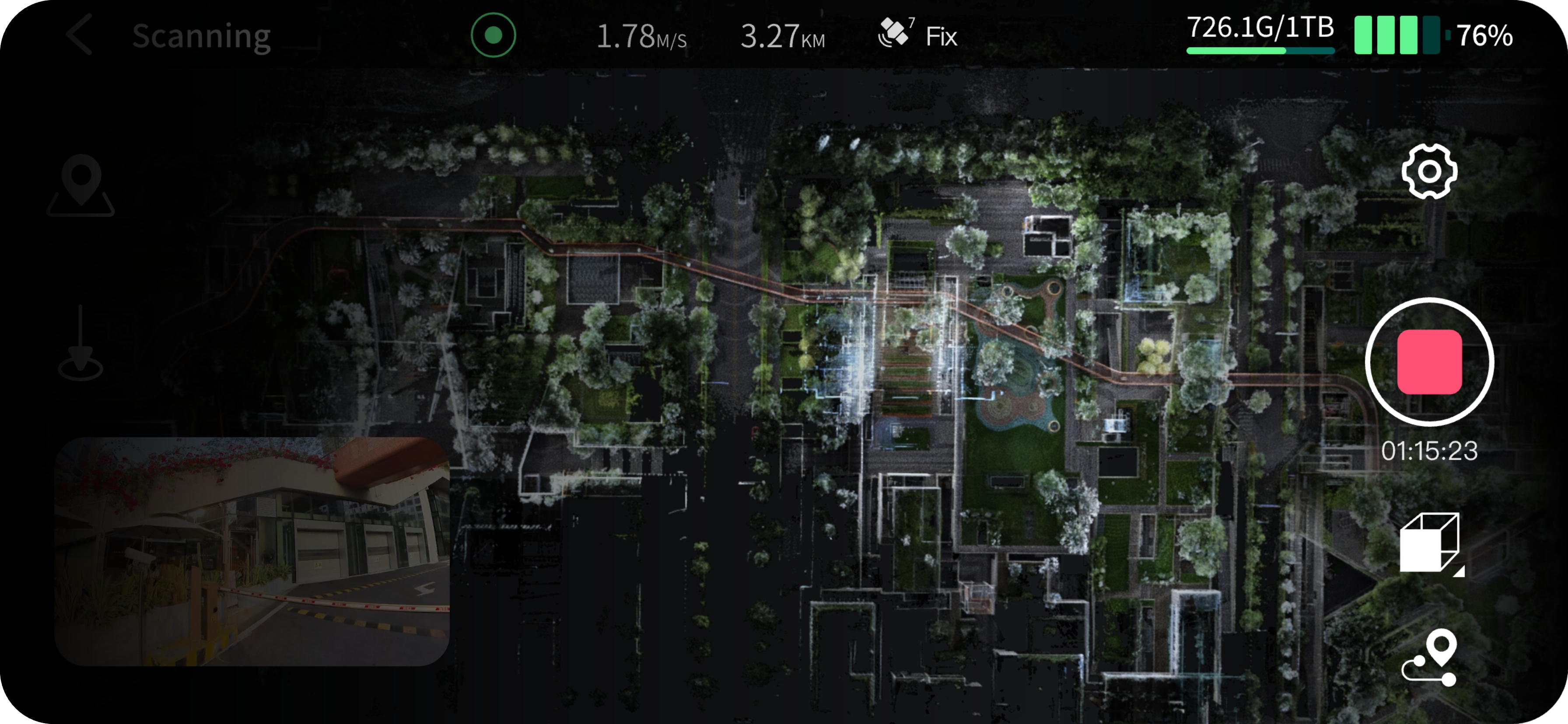
| Visual Positioning | Supported |
| Real-time RGB | Supported |
| Real-time RTK Fusion | Supported |
| Point Cloud Formats | .las |
| Image Formats | .jpeg |
| Absolute Vertical Accuracy (RMSE) | 3cm |
| Absolute Horizontal Accuracy (RMSE) | 3cm |
| Relative Accuracy (RMSE) | 2cm |
| Absolute Vertical Accuracy (RMSE) | 2cm |
| Absolute Horizontal Accuracy (RMSE) | 3cm |
| Relative Accuracy (RMSE) | 1cm |
| Repeat Accuracy (RMSE) | 2cm |
| Paint Cloud Thickness | 0.5cm |
| Horizontality (with RTK) | 0.015° |
| Verticality | 0.03° |
| Operating Range | 0.5m – 120m (0.5m – 300m) |
| Scanning Frequency | 320,000 points/s (640,000 points/s) |
| LiDAR Sensor | Class 1 / 905nm |
| Sensor FOV | 360° × 270° |
| Resolution | 2 × 45MP |
| Focal Length | 2mm |
| Aperture | F/2.0 |
| Shutter | Rolling Shutter |
| Panoramic Image Resolution | Max 68MP |
| Resolution | 1 × 1MP |
| FOV | 109° × 119° |
| Shutter | Global Shutter |
| Voltage | 14.8V |
| Capacity | 48.6Wh |
| Input | 100V–240V 50–60Hz 1.5A 60W |
| Power Rating | 74W |
| Output | 16.8V 2.0A |
| Standard RTK | Supported channels: GPS L1/L2/L5, GLONASS L1/L2, BDS B1/B2/B3, Galileo E1/E5a/E5b/E6b. Accuracy: Horizontal: ±0.6cm + 1ppm, Vertical: ±1.5cm + 1ppm |
| Survey Grade RTK | Supported channels: GPS L1/L2/L5, GLONASS L1/L2, BDS B1/B2/B3, Galileo E1/E5a/E5b/E6b. Accuracy: Horizontal: ±0.6cm + 1ppm, Vertical: ±1.5cm + 1ppm |
| Backpack with Stabilizing Arm | Dimensions: 50cm × 60cm × 15cm, Weight: 2.2kg |
| Shipping Case | Dimensions: 42cm × 74cm × 38cm, Weight with System: 6.6kg |
| 2m Extension Pole | Supported |
| Mobile Phone Mount | Supported |
| Control Point Plate | Supported |